Thermography with Multicopters
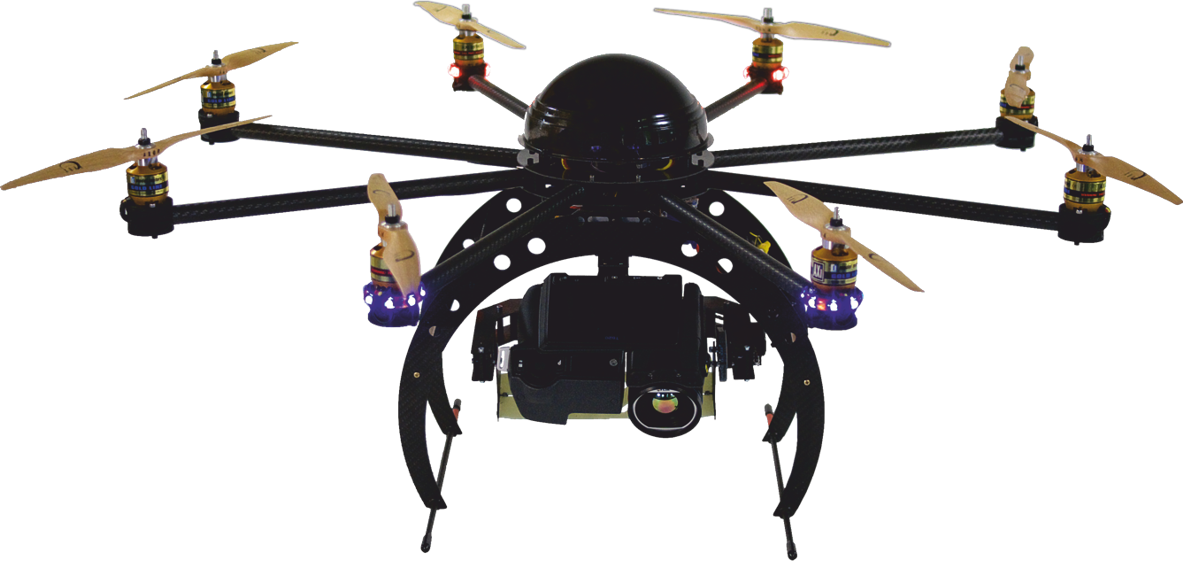
Drones with infrared cameras open new opportunities for the professional users of thermography in their daily work. The imaging temperature measurement method on the basis of the infrared survey offers a valuable aid for an early detection of the existing and developing faults. The problem is known to the experienced users of thermography. It is better to perform a measurement on a technical installation, rather than face later enormous expenses, associated with the application of multiple equipment, personnel and further expenses. This is exactly where the drones with thermal imaging camera come into use. Multicopters are deployed fast and are able to perform reliable measurements on hard to access installations. One of the options is work with the route points. The flight route for the automatic drone flight after activation is programmed in advance at the stage of flight preparation. The pilot can intervene at any time in the control of the autonomous flight. As a service company, we offer thermography and other users the opportunity to hire drones with infrared cameras with the pilots. We fly and generate radiometric images. Customers experience a holistic service with us, the purpose of which is to relieve you! We are able to respond to any requirements of our customers having at our disposal drones (octocopter and hexacopter) with integrated high resolution infrared cameras, such as FLIR T620 or Optris PI 640. Both infrared systems operate at a resolution of 640 x 480 pixel. Such system offers completely new perspectives, whether as a picture or a video of radiometric data. It is flexible and cost-effective.
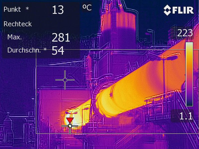
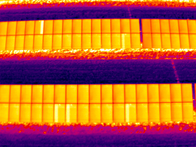
Main areas of aerial thermography application range from thermographs, utilities, electrical and industrial companies, operators of photovoltaic systems and wind parks to veterinarians, farmers and TV stations. We, at Paul Kitawa, focus on the verification of photovoltaic systems and thermography of buildings. Our services contribute to the optimization of production through identification of hotspots on the PV systems or leaks in the production shops. A further, and a very important part is the evaluation of the thermography. You will receive survey reports, which are reproducible, with clear recommendations for action. All partnerships with our customers have one thing in common: they are characterized by an open, continuous and goal-oriented way of working to meet customer requirements for the services. Depending on the requirement and application, we draw expertise from our network across Germany. Thus, our goal with the expertise to save costs on site. Our further objective is to identify and test together with our specialists new areas of application for thermography drones. We welcome your ideas on new applications and will be happy to test them in practice. Please contact us. We, as users develop ourselves multicopter systems exclusively for use in thermography to meet the requirements and objectives of our customers and partners.
Benefits of Infrared Measurements with a Drone
- Early detection of weak points
- Fault detection from any position or angle
- Higher energy efficiency through identification of weak spots of structural and power generation facilities.
- Performance of regular surveys provides for: reduction of contributions into the facility or system through the lower risk group insurance classification.
- increased system availability and reliability
- recovery of claims for profit loss from the insurance
- inspection of the technical condition in the process of normal operation without a shut off
- preventive maintenance
- detection of heat loss
- optimization of thermal insulation, energy cost saving
- basis for commercial and sanitary tests, detailed reports